Directions:
Bury Hill is a car park on the northern exit of a roundabout
on the A29 where it's joined by the A284, approximately 3 miles to the north
of the town of Arundel. It is shown on the Google map above as
the red pin in the centre of the map. You can move around
the map above in real time by clicking and dragging to change
the point of view. You can also zoom in and out and change the
map type to a satellite image or hybrid satellite and map image.
The smaller map to the top right of the main map shows a larger
scale overview, which is can also be dragged. No excuse for not
finding this place then!

Who goes there?
Popular with all bikers in the area.
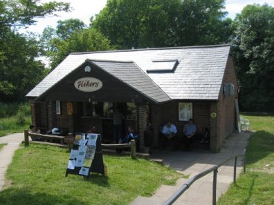
Refreshments:
On site there is a cafe called "Hikers" selling a range of
hot and cold drinks and food.
|